
Everything for the route itself.
Precise navigation, full functionality without a network and a seamless connection to public transport — three building blocks that make SagaTrail a full-featured hiking app. And because the GPS audio guide leads you through the route at the same time, the phone stays in your pocket.
Navigation worthy of a hiking app
Dense forest, wide alpine pasture or narrow valley: SagaTrail always shows you where you are and where to go. Spoken turn instructions and automatic off-route detection step in before you take a wrong turn — based on the official swisstopo maps and the Waymarked Trails network.
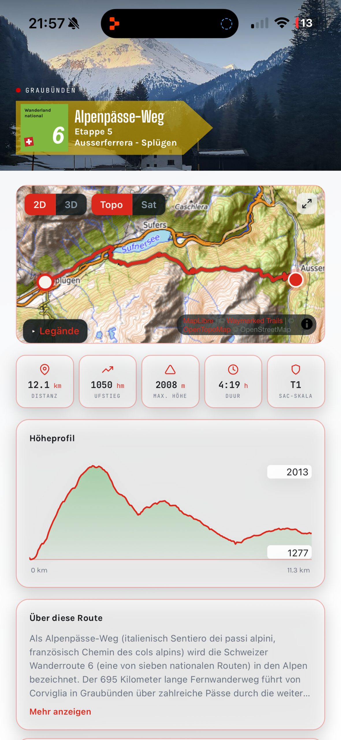
swisstopo maps
Official Swiss map base in 2D and 3D.
Live GPS tracking
Turn instructions and automatic off-route detection guide you safely to your destination.
SAC difficulty rating
Every route shows the official SAC hiking scale so you choose the right tour.
Elevation profile & distance
Detailed information on distance, elevation and estimated hiking time.
Hike, even without a network
Download legends, audio guide, route data and map tiles in advance — and hike independently of the mobile network, even in the most remote alpine valleys. As soon as the network is gone, the app switches automatically to the saved data.
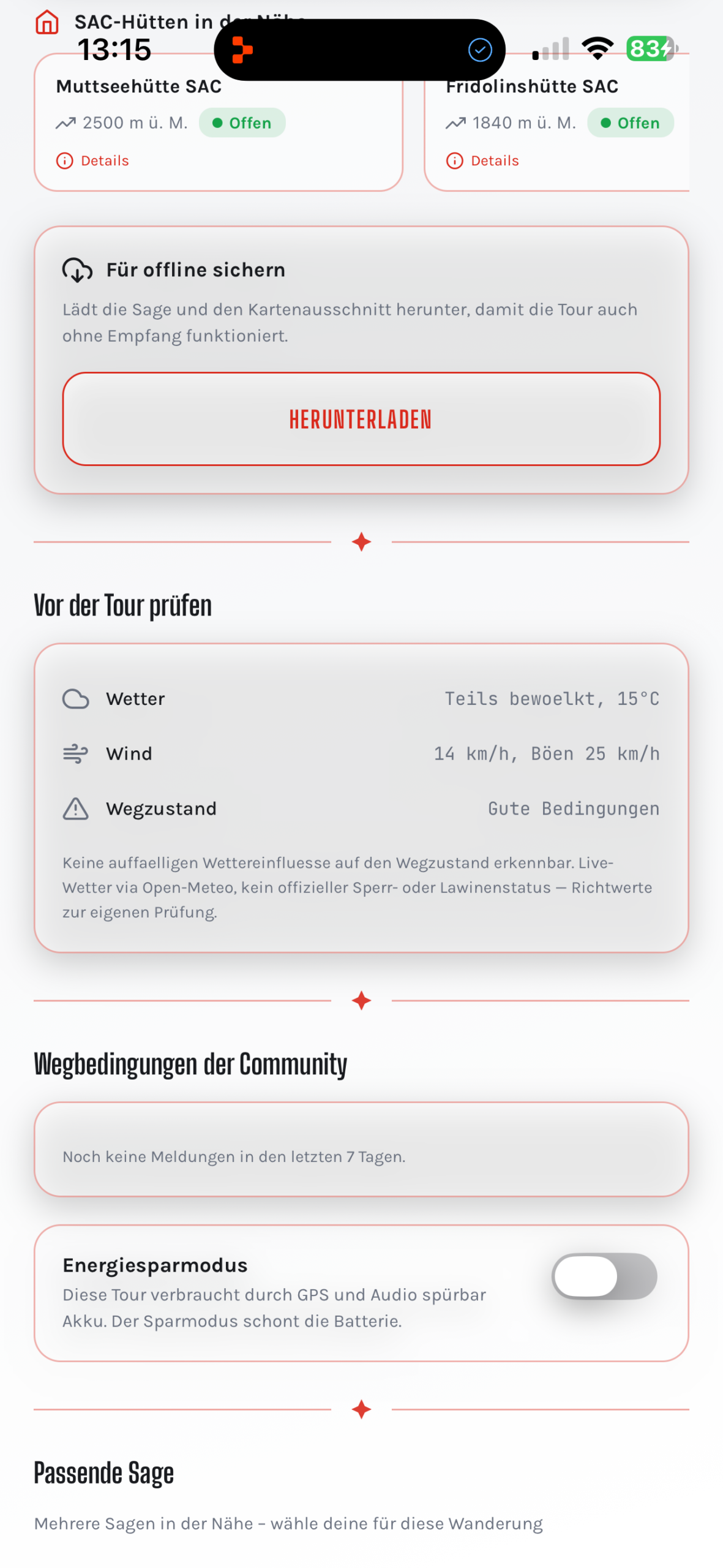
3 layers to download
Legend audio, route data and map tiles can be downloaded separately — as needed.
Progress indicator
See at any time how much has already been downloaded and how much storage is needed.
For remote areas
Ideal for high-alpine tours and regions without mobile reception.
Automatic switching
The app detects a missing network and automatically falls back on offline-stored data.
Seamlessly from the station to the trailhead
Direct SBB integration shows you departure times at the start and end point of your route — including real-time delays and a one-click link to sbb.ch. This way you plan your outbound and return journey without leaving the app.
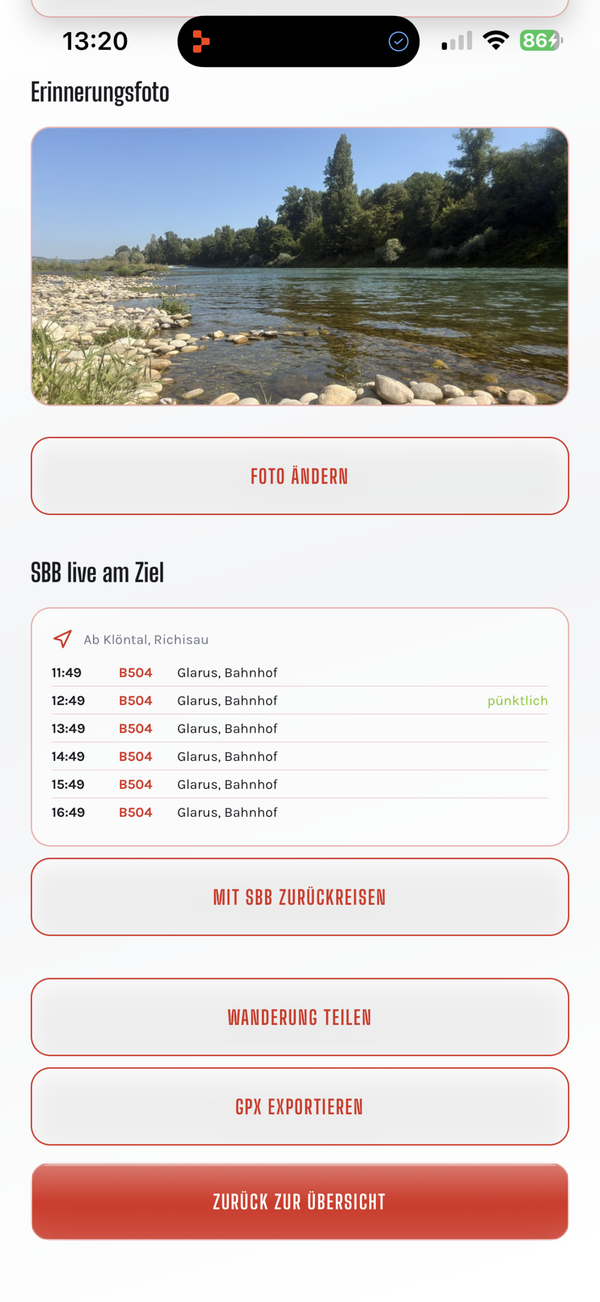
Departure times
Live departure times at the start and end point of your chosen route.
One click to SBB
Direct link to sbb.ch for timetable and ticket purchase.
Real-time delays
Delays are shown in real time so you can plan your return journey.
Point-to-point hikes possible
Handy for hikes that end at a different station than they start.
All features at a glance
A complete list of all features around navigation, offline use and public transport connection.
| Navigation & maps | |
| swisstopo map base | Official Swiss national maps, displayable in 2D and 3D view. |
| Waymarked Trails network | The official Swiss hiking trail network as the basis for all routes. |
| Live GPS tracking | Your position is shown continuously on the map, including viewing direction. |
| Turn instructions | Active hints at junctions and forks so you don't stray from the path. |
| Off-route detection | The app automatically detects when you deviate from the planned route and suggests a correction. |
| SAC difficulty rating | Every route shows the official SAC hiking scale (T1–T6) for a realistic assessment. |
| Elevation profile & distance | Distance, elevation (ascending and descending) and estimated hiking time per route. |
| Offline mode | |
| Legend audio offline | Audio narrations and the audio guide can be downloaded in advance and played without a network. |
| Route data offline | The complete routing incl. turn instructions works without mobile reception. |
| Map tiles offline | Map sections are stored locally and displayed without an internet connection. |
| Download progress indicator | See at any time how much has already been downloaded and how much storage is needed. |
| Automatic switching | The app independently detects a missing network and falls back on offline-stored data. |
| Transport & SBB | |
| Departure times at start point | Live departure times of the next connections from the start point of your route. |
| Departure times at end point | Likewise for the end point — especially handy for hikes without a return path. |
| One click to sbb.ch | Direct link to the SBB website for timetable information and ticket purchase. |
| Real-time delays | Current delay notifications so you can plan your return journey realistically. |
| Support for point-to-point hikes | Even if the start and end stations differ, the app shows both departure times. |
Navigation, offline & transport — all in one app.
Download SagaTrail for free and start your first hike with a story.
App Store