
Safe on the trail, anytime.
Direct SOS calling, automatic emergency SMS with GPS coordinates and up-to-date weather and avalanche data — SagaTrail doesn't leave you alone, even far from civilisation.
What this feature does for you
A sudden change of weather, a fall in the terrain or a closed passage: SagaTrail bundles everything that matters in an emergency. One tap connects you to rescue services, your emergency contact is notified automatically, and weather, avalanche and trail-condition data warn you before things get critical.
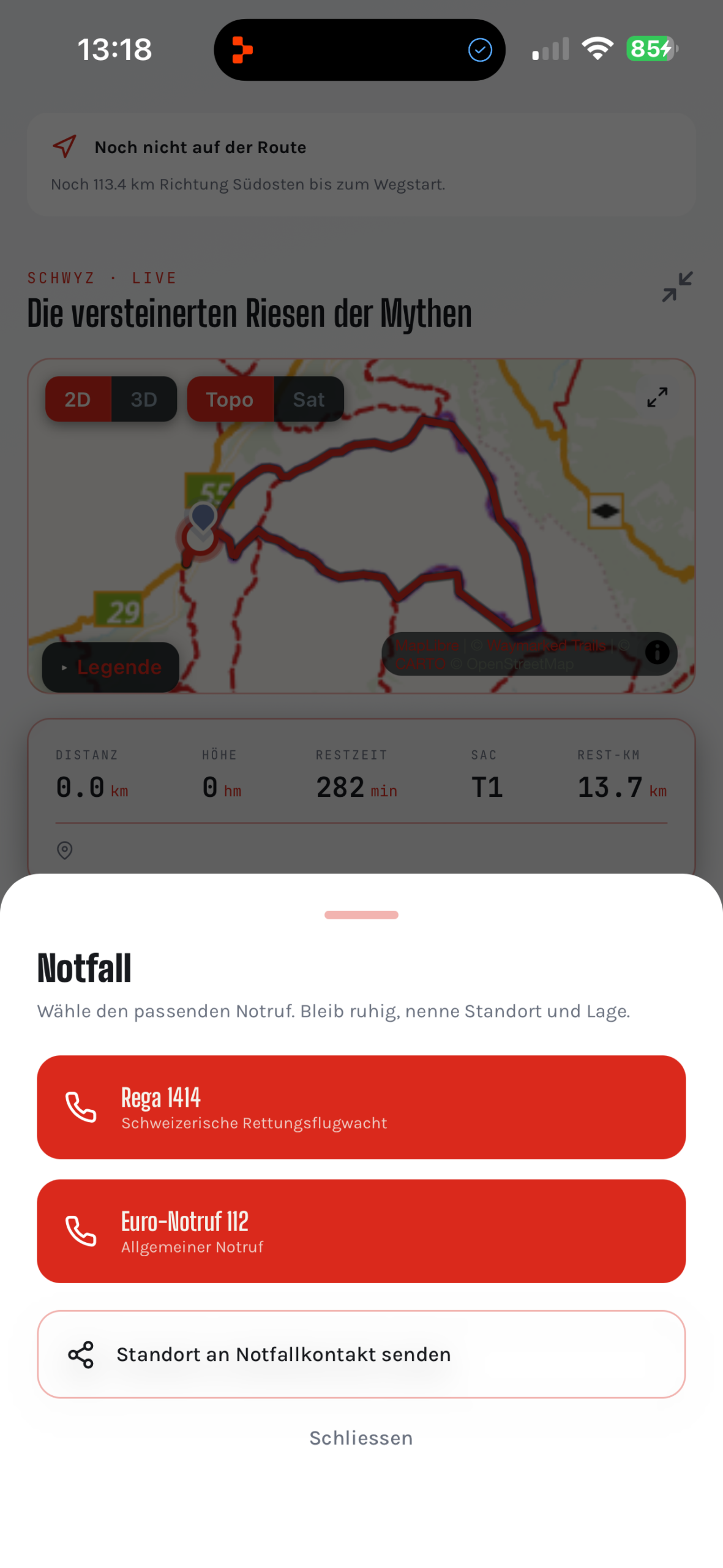
Direct SOS calling
One tap connects you directly to Rega or the European emergency number.
Emergency contact
In an emergency, an SMS with your GPS coordinates is sent automatically to your emergency contact.
Live weather
Current weather data for your location and your route.
Avalanches & trail conditions
EAWS avalanche bulletin and community reports on the current trail condition.
Route community
Other hikers report current hazards, obstacles and trail conditions directly on your route.
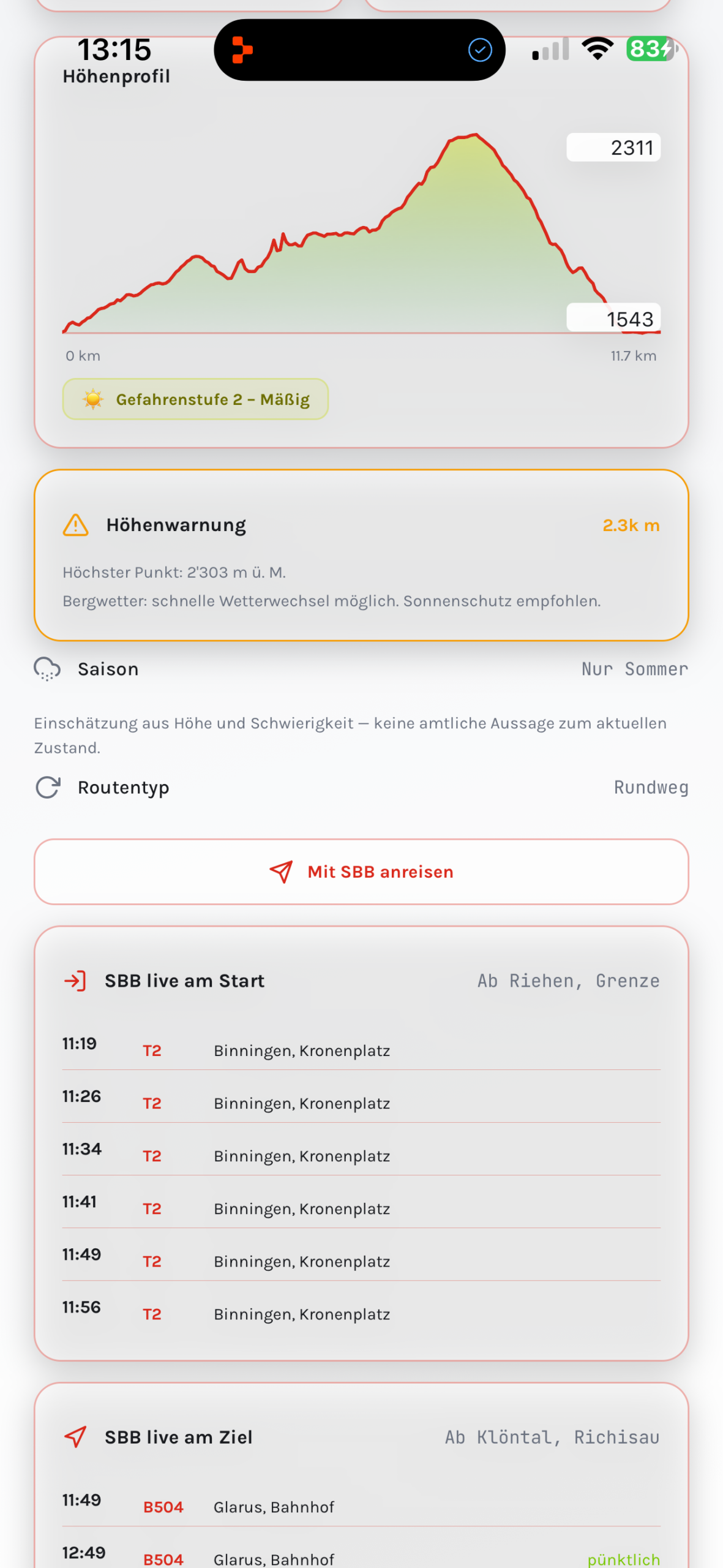
Elevation profile with safety layers
The elevation profile shows additional layers such as avalanche risk or demanding passages directly along the route.
Elevation profile with safety layers
Instead of a plain elevation curve, SagaTrail shows additional layers directly in the profile — such as avalanche slopes, exposed passages or reported trail problems. At a glance, you can see where along the route particular caution is advised.
All safety features at a glance
A complete list of all safety-relevant features of SagaTrail.
| SOS & emergency | |
| SOS button | Direct call to Rega (1414) or the European emergency number (112) — pre-selected automatically depending on your location. |
| GPS coordinate transmission | When the SOS call is triggered, your exact coordinates are transmitted automatically. |
| Store an emergency contact | Designate a trusted person who will be notified automatically if needed. |
| Automatic SMS sending | The message to the emergency contact includes location, time and a link to the live position. |
| Weather & avalanche | |
| Live weather data | Current temperature, precipitation and wind forecast for your respective location. |
| Weather along the route | Forecast separately for the start, intermediate and end point of your hike. |
| EAWS avalanche bulletin | The official 5-level European avalanche danger scale, integrated directly in the app. |
| Elevation profile with safety layers | Critical passages such as avalanche slopes or steep steps are highlighted in colour in the elevation profile. |
| Community & trail condition | |
| Route community | Other users report obstacles, closures or dangerous passages on the route. |
| Trail-condition reports | Real-time notes on snow, ice or erosion on individual trail sections. |
| Create your own report | You can leave your own observations, which are shown to other hikers. |
| SAC difficulty rating | Every route shows the official SAC hiking scale so you can assess your ability realistically. |
Experience safety and weather yourself.
Download SagaTrail for free and start your first hike with a story.
App Store